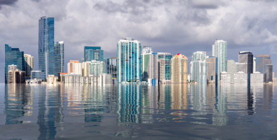
When people think about threats to coastal cities, rising sea levels often come to mind. But there is another, less visible problem that can make flooding even worse: land subsidence.
Land subsidence occurs when the ground gradually sinks. In some places, the process is caused by natural geological changes. In others, human activity - particularly excessive groundwater extraction—plays a major role.
The challenge for cities is that subsidence can damage infrastructure, increase flood risk, and make the effects of rising sea levels more severe. While there is no single solution for every location, engineers, water managers, and urban planners are developing strategies to reduce the problem and protect communities.
Land subsidence can happen for several reasons, including the compaction of underground sediments, groundwater withdrawal, natural geological processes, and the dissolution of minerals beneath the surface.
One of the most common human-related causes is pumping groundwater faster than an aquifer can naturally recharge.
Aquifers are underground layers of rock, sand, or gravel that store water. When groundwater is removed, pressure within the aquifer can decrease. In some geological settings, the surrounding sediments compact under the weight of the ground above them. As that compaction occurs, the land surface can sink.
The effects may be gradual, but they can be significant. Roads, buildings, pipelines, drainage systems, and other infrastructure can all be affected.
In coastal areas, the problem becomes even more serious. When land sinks while sea levels rise, the relative water level increases more quickly, making flooding and saltwater intrusion more difficult to manage.
One of the most direct ways to address human-caused subsidence is to reduce the amount of groundwater being removed.
This may involve establishing pumping limits, improving water-use efficiency, monitoring aquifer levels, and developing alternative water supplies. The goal is to keep groundwater withdrawals within sustainable limits so that underground water systems are not continually depleted.
Tokyo provides a well-known example. Excessive groundwater pumping contributed to severe land subsidence during the twentieth century. Japan introduced measures to control groundwater extraction, and subsidence rates in affected metropolitan areas subsequently slowed.
The lesson is straightforward: water management is also land management. Protecting an aquifer can help protect the ground above it.
Reducing groundwater extraction is important, but some regions also need to restore water to underground systems.
Managed aquifer recharge involves intentionally replenishing an aquifer using sources such as captured stormwater, surface water, or highly treated wastewater. The water may be introduced through recharge basins, infiltration systems, or specially designed wells.
One example is the Sustainable Water Initiative for Tomorrow (SWIFT) in southeastern Virginia. The program, operated by the Hampton Roads Sanitation District, treats wastewater to a high standard and recharges it into the Potomac Aquifer. The project is intended to create a more sustainable groundwater supply and reduce the pressure associated with excessive withdrawals.
The U.S. Geological Survey is monitoring the program's effects on groundwater levels, aquifer compaction, and land movement. That monitoring is important because the success of a recharge project depends on local geology, water chemistry, pumping patterns, and the behavior of the aquifer itself.
Cities cannot effectively manage subsidence without understanding where, why, and how quickly the ground is moving.
Engineers and scientists use tools such as:
The USGS Virginia Extensometer Network, for example, measures aquifer-system compaction and helps researchers understand how groundwater withdrawals affect land movement. In some locations, reduced pumping has been associated with aquifer recovery and measurable uplift.
Monitoring also helps cities identify areas where infrastructure may be at greater risk and determine whether mitigation efforts are having the intended effect.
Not every cause of subsidence can be stopped. Natural geological processes may continue even when groundwater use is carefully managed.
In those cases, the focus shifts toward designing infrastructure that can tolerate ground movement and reducing the consequences of flooding.
Depending on local conditions, strategies may include:
These measures do not necessarily stop subsidence. Instead, they help cities remain functional and resilient as ground conditions change.
Urban development often replaces natural soil with roads, parking lots, sidewalks, and buildings. These surfaces can prevent rainfall from infiltrating the ground.
Permeable pavement, rain gardens, bioswales, wetlands, and other green infrastructure can help capture and manage stormwater. In suitable locations, these systems can allow more water to infiltrate the soil and contribute to groundwater recharge.
This approach is sometimes associated with the idea of a “sponge city” - an urban environment designed to absorb, store, and gradually release rainwater rather than sending it immediately into drainage systems.
Permeable surfaces are not a universal solution to subsidence. Their effectiveness depends on soil conditions, groundwater depth, contamination risks, and the design of the recharge system. But they can support broader water-management and flood-resilience goals.
Land subsidence and sea-level rise are separate processes, but their effects can overlap.
A city may need to address both the causes of sinking land and the flooding risks that result from it. That means combining water management with long-term infrastructure planning.
For example, urban planners may incorporate:
These strategies can help reduce the damage caused by flooding, even when subsidence cannot be completely prevented.
In some cases, reducing groundwater extraction and restoring aquifer pressure can slow subsidence. In certain geological settings, portions of the ground may even recover through aquifer rebound.
However, not all subsidence is reversible. Once certain underground clay layers have compacted, the lost elevation may be permanent. That is why prevention, monitoring, and early intervention are so important.
The most effective response depends on the cause of subsidence, the local geology, the availability of water, and the infrastructure already in place.
Land subsidence is a complex problem, but it is not simply a matter of watching the ground sink. It is a challenge that connects water management, civil engineering, urban planning, and infrastructure design.
By reducing excessive groundwater extraction, replenishing aquifers where appropriate, monitoring ground movement, and designing cities with future flooding in mind, communities can reduce their vulnerability and make better-informed decisions about long-term development.
The ground beneath our cities may be moving - but with careful planning and the right engineering solutions, cities can become better prepared for the changes ahead.